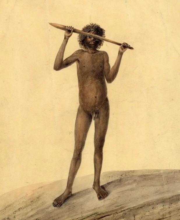
John William Lewin – Towwaa (aka “Tom Ugly”), native of Jervis Bay, New South Wales 1810. Watercolour 27.1 x 21 cm. British Museum No. 1893, 0803.50. Image: Supplied.
In the 19th century the words “Woronora” and “Waniora” to describe the headland at Bulli today known as Sandon Point were sometimes used interchangeably.
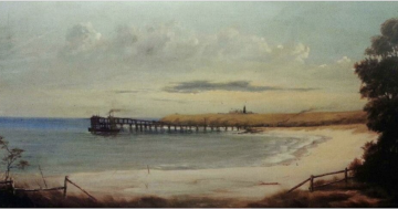
I’ve long puzzled why and my curiosity was recently again raised when I saw both the watercolour pictured above and a December 1920 advertisement in an obscure newspaper titled The Propeller (published in Hurstville) announcing that “the well-known Woniora Pleasure Grounds at Tom Ugly’s Point … have been subdivided”.
Until the Tom Uglys Bridge was opened to traffic in 1929 the first major hassle getting from Sydney to Wollongong was crossing to “Tom Ugly’s Point”. The second was getting down the top of the escarpment to Bulli.
In 1843 the Australian newspaper announced that “a way has been discovered and marked out, which, at eleven and a half miles from the navigation of the Woronora, reaches the Illawarra Range … This new-marked line falls in with the present road to Bulli, which was the original road into Illawarra, and which, descending as it does here, from the lowest part of the great range, along a spur terminating only in Woniora Point, presents facilities for the formation of a better ascent in the straight line between Woollongong [sic] and Sydney, than can be found at any other part in a less direct line.”
The problem, however, is that the spur referred to above ended at Bulli Point (today’s Sandon Point) rather than today’s Woniora Point located just a little further south.
And the map seen below does seem to correctly place “Woniora Point” just a little south of Bulli Point (aka Sandon Point).
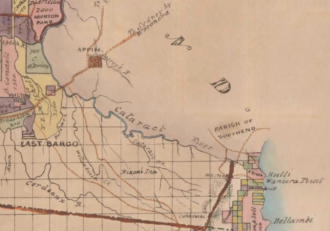
Map of the County of Camden (showing Woronora to Bellambi). Dedicated by permission to Sir T.L. Mitchell, Knt., Surveyor General of NSW. Compiled expressly for the printer and publisher of the Australian Atlas, W. Baker, Hibernian Printing Office, King Street, East Sydney. Printed and published by W. Baker, 1843-1846. Image: Supplied.
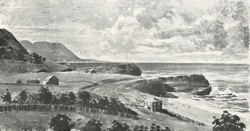
“The Bight of Bulli (surveyed in 1868, by Lieutenant [John Thomas Ewing] Gowlland and Mr. George of the Royal Navy) is formed by a slight curve in the coast, the southern extremity being furnished by Woniora Point … The flag staff, on this bleak and barren but not very elevated projection, stands in latitude 34, 20, 8 south … For more than 800 feet round this point there is a dangerous rocky shoal, awash at low water; the rise and fall of the tide being rather more than five feet. Inside the bight, to the north (and partly sheltered by the little promontory) the pier [Bulli Jetty then standing on the north side of today’s Sandon Point] projects from the land for several hundred yards, its extremity being about 800 feet from the point.”
So, back then, as Bulli’s “Woniora Point” was sometimes called “Woronora Point” and today’s “Tom Ugly’s Point” was sometimes called “Woniora Point” the authorities initially changed it to “Dover Point” supposedly to prevent confusion as the road to the Illawarra went from there to “Woniora Point” at Bulli.
But this itself was a confusion for the spur leading down to the beach from Bulli Pass originally seems to have followed the ridge above Woodlands Creek straight to “Bulli Point” (aka today’s Sandon Point) rather than on to the low headland and reef just to the south called “Woniora Point”.
Woniora Point at Bulli seems to have been given early greater maritime significance because the off-shore reef – extending mostly underwater some 500 metres to the east – posed a risk to navigation whereas most vessels with sober sea captains were able to see Bulli Point more clearly and steer wide of it.
Intriguingly, however, “Tom Ugly’s Point” itself may have more Illawarra and South Coast significance than most would guess.
Despite several wild theories as to who “Tom Ugly” might have been, Sydney historian Keith Vincent Smith contends he was not a European but a different individual “whose remains were found buried at Tom Ugly’s Point”. This man was “an aboriginal named ‘Towwaa’ or ‘Towweiry’, nicknamed ‘Tom Ugly’. He was from the South Coast around Jervis Bay, but later lived, died and was buried under a ‘gibber gunyah’ (rock shelter) on the point of the Georges River that now bears his name”.
And, remarkably, at the British Museum in London, the fabulous portrait by John Lewin of this Indigenous person (depicted as a young man) which heads this story survives.
So, in short, the European transliteration of the presumed Indigenous words “Woronora” and “Waniora” were, originally, likely to be the same word. But its meaning – like so much of the knowledge about the Illawarra and the Aboriginal bush tracks the white invaders likely first followed to get down the escarpment – is mostly lost or at least unknown to Europeans.
So when early so-called Australian explorers write in their journals, “I have found a track” it most probably should read, “I’ve stumbled upon a long established traditional Indigenous pathway”.