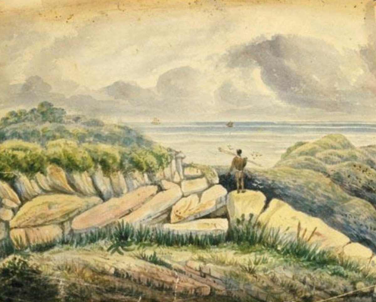
Robert Hoddle’s watercolour titled View from Illawarra Range En Route to Kiama 1830. It was drawn in 1847 after Hoddle had moved to Melbourne. Photo: Supplied.
Today Illawarra’s most euphonious street is, of course, Bong Bong Road in Dapto.
It was so named because Bong Bong was once a more important place than Dapto in colonial NSW and so people on the coast wanted to get there even long before the annual Bong Bong Picnic Races and drinking festivals were first invented.
The locals eventually had a good go at getting up the escarpment from West Dapto and if you are fit and hardy you can still sort of follow along what might be the remains of the goat track that was early attempted in this location.
The hero of getting from Bong Bong to the coast, however, was the surveyor Robert Hoddle (1794-1881). Today a 6 km bit of what is thought to be his track, climbing over some 300 m, still extends from Kiama’s Saddleback Mountain and is even serviced by a convenient car park. (Please note: Hoddles Track is currently closed due to fallen trees and track maintenance issues. Keep an eye on the Destination Kiama website to check if it’s open.)
But how tough it was for Hoddle and his convict servants to cut through the notorious Jamberoo brush was exacerbated by the fact the government had neglected to provide boots for the convicts appointed to assist him and so the going would have probably been worse than most today could possibly imagine.
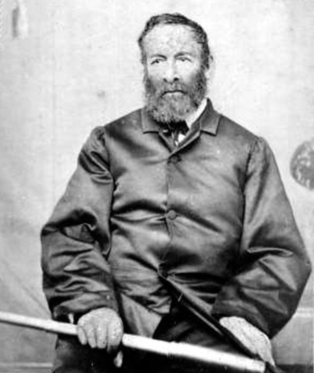
Robert Hoddle c.1865 with his surveying telescope. The surveyor and artist became Surveyor General for Victoria from 1837-1853. Photo: Supplied.
Even while, amazingly, Hoddle’s team apparently being successful in cutting a rough route from Bong Bong to the coast there was, eventually, to be another benefit to the foot weary.
The famous Lupton’s Inn stood 60 miles (96 km) from Sydney, where the Great South Road continues through what is termed the Bargo Brush – a tract of barren land shut in by the rocky ravines of the Nepean on the east and by those of the Bargo River on the west.
Eight miles beyond is Little Forest, a spot of grassy land where, eventually, a small inn had been established. The settlement was closely surrounded by bushy hills and a mile beyond lay the road to Bong Bong.
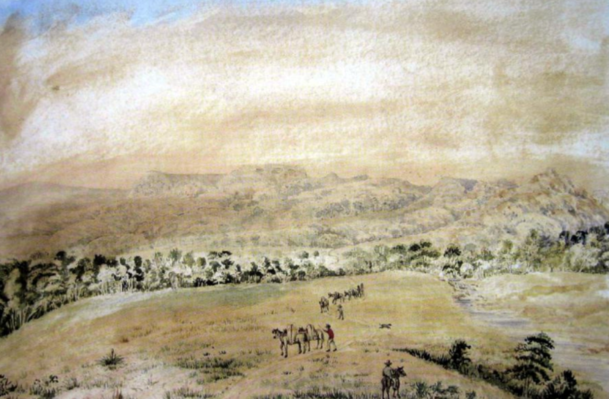
Robert Hoddle’s watercolour, Party en route Bong-Bong to Bujjon. Photo: Supplied.
Here in 1834 it was proposed to officially formalise the township of Bong Bong – a plan soon abandoned in favour of Berrima.
In the country to the eastward (even further south into the deep ravines of the Shoalhaven River) a track seems to have also led down the Meryla Mountain which first crosses the Kangaroo River and the Bujjon (aka Budjong) Creek to which a Robert Hoddle watercolour – Party en route Bong-Bong to Bujjon – makes mention.
To this Meryla Road a path also led from Bong-Bong and that may, possibly, be one of the tracks Robert Hoddle and his convict crew first cut through.
A map by Hoddle is the earliest known record of the word “Meryla” and, fittingly, a Meryla Street today crosses Hoddle Street in the town of Robertson above Kiama.
Before laying out the now-celebrated rectilinear streets of Melbourne, Hoddle’s work had been needed to try to open up a route from the pastures in the Southern Highlands to Kiama Harbour in the hope of a faster route for produce to be shipped to Sydney.
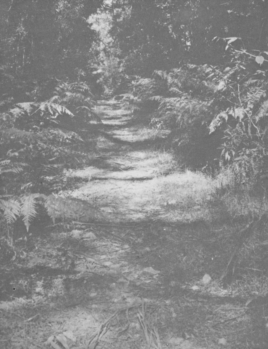
A presumed remnant of Hoddle’s Track on Saddleback Mountain. Photo: Supplied.
So in July 1830 Hoddle started at the Wingecarribee Swamp (presumably near today’s small town of Burrawang) and surveyed the Illawarra Escarpment in an attempt to find a way to Saddleback Mountain and down to Kiama.
In his diary Hoddle described the rainforest of the escarpment as “the most formidable brush”.
But it wasn’t until the 1860s that Hoddle’s early rough path from the highlands to Kiama was partly rediscovered by those seeking new land that a rather circuitous track was then established linking Wingecarribee to Kiama Harbour and, eventually, in 1864, a route up Jamberoo Mountain was surveyed but not by Hoddle.
More likely, it was just part of a gradual process as the area developed from a track or path into a formal road – and some today argue that Jamberoo is itself an indigenous word meaning “path” or “track”.
Hoddle was appointed auctioneer at the first sale of Crown Land in today’s Melbourne in 1837, where he sold half-acre allotments averaging just over £35 an acre.
Hoddle’s commission was some £57, so he bought two allotments for himself costing £54. He was thus soon able to retire to a salubrious Melbourne home with a large drawing room where he entertained the good and the great – some of whom painted versions of Hoddle’s many sketches made in early Illawarra.
Not at all bad for a bloke who started as a cadet-surveyor in the British Army in 1809 and took part in survey work in Britain and the Cape Colony (South Africa), prior to migrating to NSW in July 1823.