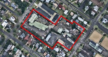


Flinders Street is being pitched for the region’s next big boom, with a council plan set to guide development. Photo: Region.
A roadmap for the Flinders Street Precinct to guide future development along the key stretch into the city has been adopted by Wollongong City Council, but unanswered parking, traffic and building height concerns are set to linger as the area progresses.
It’s currently a corridor of construction, cranes and car yards, but as the gateway into the Wollongong CBD, Flinders Street has been earmarked as a future hub of activity and housing.
The Flinders Street Precinct Urban Design Framework (UDF) aims to give that development the direction needed to match growth and manage important liveability aspects.
“We’re already seeing changes in the area with the number of shop-top residential developments either built or approved in the precinct,” Wollongong Lord Mayor Tania Brown said.
“We want to see that continue, but anyone who’s travelled along Flinders Street in the car at peak times will know it’s slow going and it doesn’t offer a great deal in terms of pedestrian experience, both in terms of accessibility and amenity.
“We want to encourage development in the area, while also providing new public open spaces, fresh landscaping and tree cover, and active transport links to truly see it thrive. We’re also making sure that we maintain the views of Mount Keira that we all love.”
The plan outlines potential for different types of zoning and development in the area – expected to host thousands of people – and was created after strong interest from developers in the region.
But during council’s debate on whether they should progress the plan, there were concerns raised about whether the area could handle the increase.
“Potentially we’re adding a whole new suburb of Wollongong in that one area; by the time that area is all developed there could be 5000 people or more just in the precinct,” councillor Andrew Anthony said.
“I just feel that a lot of the infrastructure has to come first; we can’t just wait until later to deal with these problems.
“I really just don’t understand who’s going to pay for all this additional infrastructure. The developer contributions aren’t going to cover it all; should the entire city be fitting the bill for this?”
While those concerns, particularly around traffic management, were echoed by others, the UDF was not designed to work in isolation, with a number of policies, including development control plans, urban greening and access and movement strategies to address some of the issues.
Further consultations would also take place when development applications for specific projects were lodged.
“This framework will help us to advocate to the State Government for improved traffic measures all around that area as those main routes of Bourke Street, Flinders Street and Throsby Drive are managed by the State Government,” Cr Brown said at the meeting.
“I do want to acknowledge that the framework does not address all of the parking issues, we know there is limited street parking in this area, we see it around North Wollongong train station so we know that the future DAs need to address that with onsite parking that is adequate to meet the needs of the people who will be living in there.”
The plan was adopted by council after a public consultation which received feedback from 49 participants, with further consultation on applications to be undertaken as projects develop.