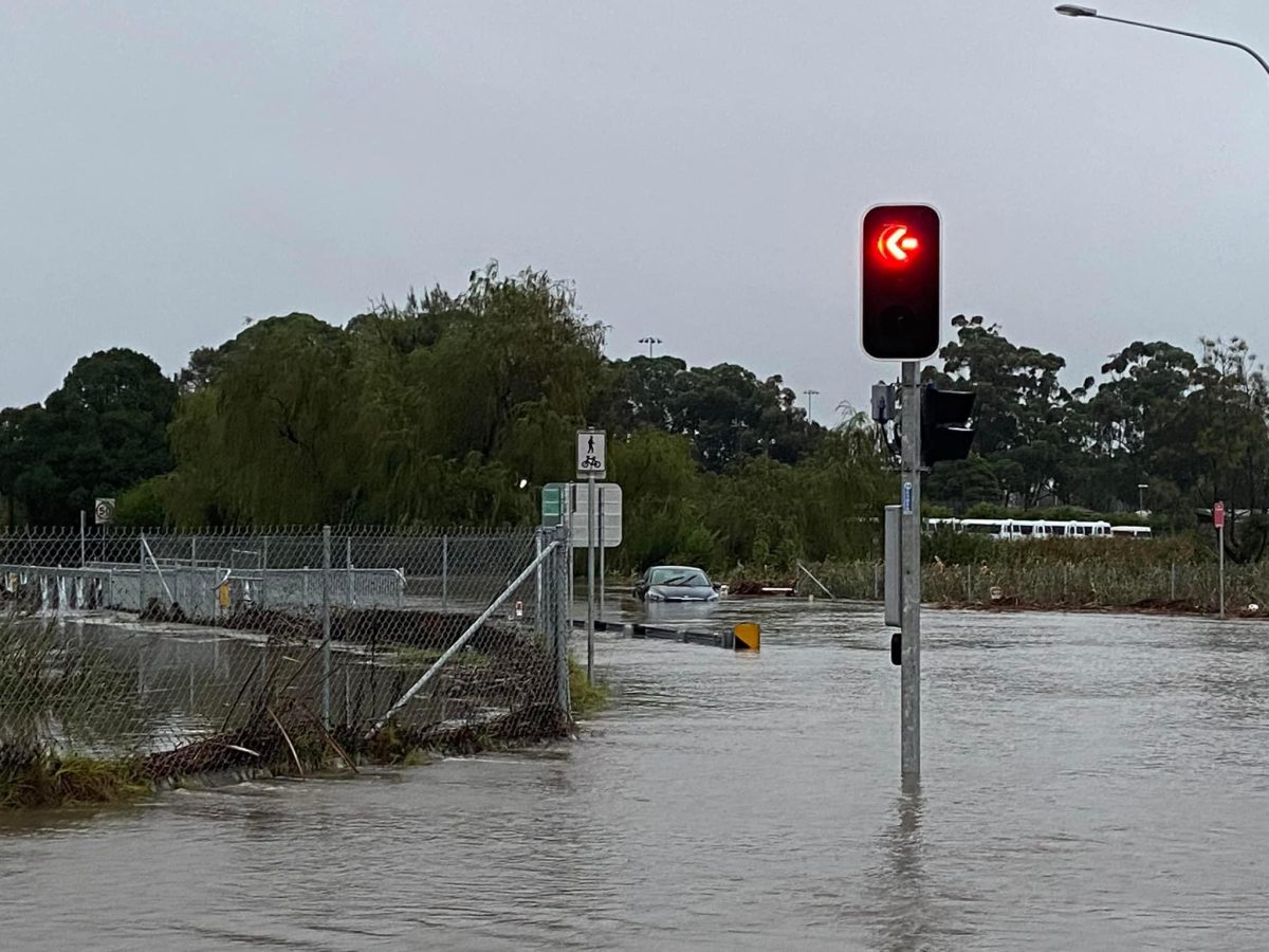
Flooding at the Illawarra Highway off-ramp onto Tongarra Road, Albion Park. Photo: SES Shellharbour City.
Community feedback is sought on a flood management plan set to deliver key upgrades to flood-prone areas across five Shellharbour suburbs — including raising roads and purchasing high-risk properties.
At a recent Shellharbour City Council meeting, councillors endorsed the draft Horsley Creek Floodplain Risk Management Study and Plan to go on public exhibition until 30 June.
It defines the current and future flood risk to the community and identifies a number of actions to ensure future development and flood response is compatible with those risks.
As an update to the 2017 study and plan, key potential improvements in the new documents include raising Industrial Road at Casuarina Street to ensure ambulance access during floods and exploring the purchase of two properties significantly impacted by flooding.
Councillor John Davey said it was now eight years down the track from the original plan, with new flood estimations and modelling methods defining flood behaviour for the 963-hectare Horsley Creek catchment, which takes in Albion Park Rail, Oak Flats, Blackbutt, Croom and Albion Park.
“The report itself identifies a number of things that we could address to achieve our floodplain risk situation ourselves, but there are two caveats to that,” Cr Davey said.
“The first caveat is funding, and the second one is that some of the responsibility lies with other agencies and with private landholders.
“We don’t have the funding available to make the upgrades or changes we’d like to make, and in some of the other instances, we don’t have the authority or the power.”
However, he said there were items flagged that could improve its situation in the Horsley Creek catchment area.
“The possibility of raising Industrial Road at Casuarina Creek to provide flood-free access for the ambulances, I think that should be something we’d make a note of in terms of a high priority,” he said.
“They also identify the potential purchase of two properties subject to flood issues – once again though, subject to funding.”
The two properties are on the western side of Station Road at Albion Park Rail and were identified in the previous 2017 study and plan.
Cr Davey said the study also pinpointed several areas requiring some “TLC” and funding, including flood-prone locations in Maple Street at Albion Park Rail, Brigadoon Circuit at Oak Flats, and Theodore and Lang streets at Oak Flats.
Other recommendations included a community flood education and awareness program, flood modification measures involving the creation of detention basins at Pioneer Drive in Blackbutt and Tongarra Road in Albion Park.
Cr Moira Hamilton said she was happy to see it going on public exhibition until 30 June to allow the public to provide feedback on the proposed flood management strategies, which aim to prevent or reduce the impact and losses from flooding on private and public land.
With the adoption of a final Floodplain Risk Management Plan, council will be able to apply for grant funding under the NSW Floodplain Management Program to implement the measures identified in the final plan and in accordance with State Government priorities.
Future financial considerations will be identified in council’s delivery programs.
Moved by Cr Kellie Marsh and seconded by Cr Davey, the draft plan was unanimously endorsed to go on public exhibition.
Drop-in sessions will be held at the Shellharbour Civic Centre on 11 June at 10 am and 5:30 pm or it can be viewed online until 30 June.