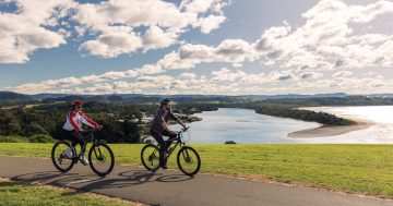
Long stretches along the coast and cycle loops around the town help you explore and stay active. Photo: Destination NSW.
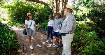
It’s time to ditch the car this summer and get out to see the best of Kiama on foot or by bike.
While the town can be a calm place to relax, there are plenty of active ways to also enjoy the scenery whether it be along the coast or in the forest.
These walks and rides are the perfect way to discover Kiama while enjoying the outdoors and getting in your daily steps.
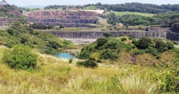
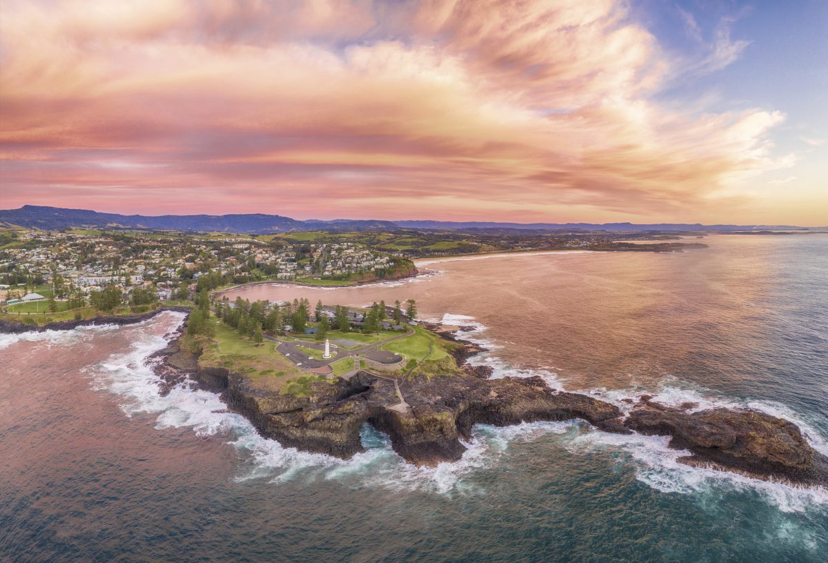
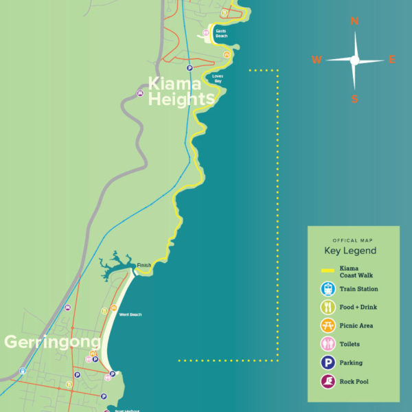
Kiama Coast Walk
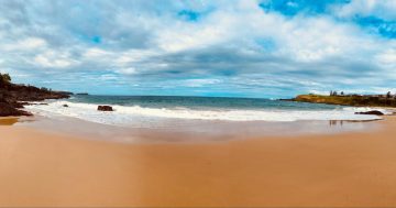
It’s one of Australia’s most scenic walks, with ocean views, spectacular rock formations and unspoilt beaches.
The Kiama Coast Walk stretches for around 20 km and can be broken up into three sections for shorter adventures.
The North Section
The north section runs from Minnamurra River to Kiama Blowhole, starting at Minnamurra train station and heading south to James Oates Reserve and the river mouth.
Along the way look out for the Minnamurra Whale Watching Platform at the headland with stunning views of Mystics and Killalea beaches plus Rangoon Island.
You’ll then travel to Jones Beach, the Cathedral Rocks and experience the hidden beauty of ‘The Boneyard’.
A detour to see the eerie basalt columns of Bombo headland is also worthwhile.
When you make it to Bombo Beach, walkers have the option to veer west under the highway onto Kiama Cemetery and Spring Creek Wetland or continue along the beach until the blowhole.
This section is 8.5 km and takes around three hours to complete.
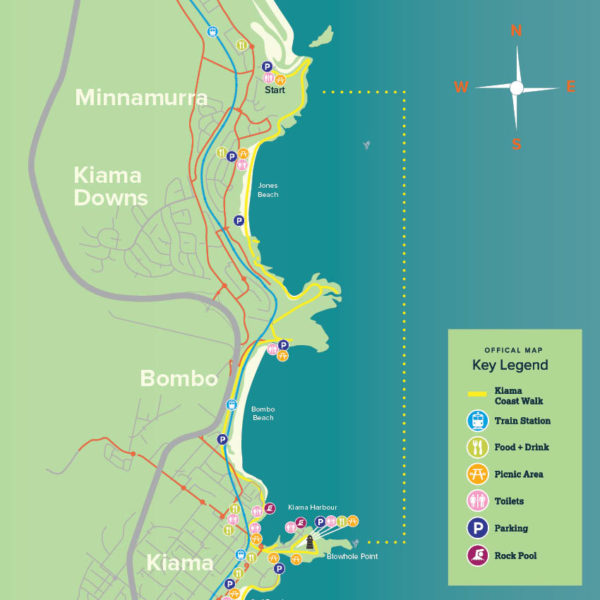
The north section of Kiama Coast Walk. Image: Destination Kiama.
The Midsection
The midsection of the walk is shorter but a bit harder, with the route marked out from the blowhole to Loves Bay.
Here you’ll go through a series of waterfront reserves of Storm Bay, Surf Beach, Kendalls Beach, Easts Beach and Loves Bay, laced together by headlands.
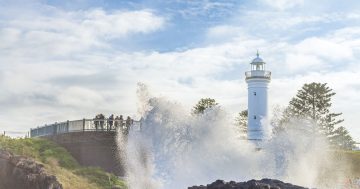
The Little Blowhole is also midway along this walk, which is arguably more consistent than the Kiama Blowhole, and puts on regular spectacular displays.
The final headland at Kiama Heights is a great spot to see how far you’ve come before finishing up this leg at Loves Bay.
This section is 6 km and will take about one and a half hours.
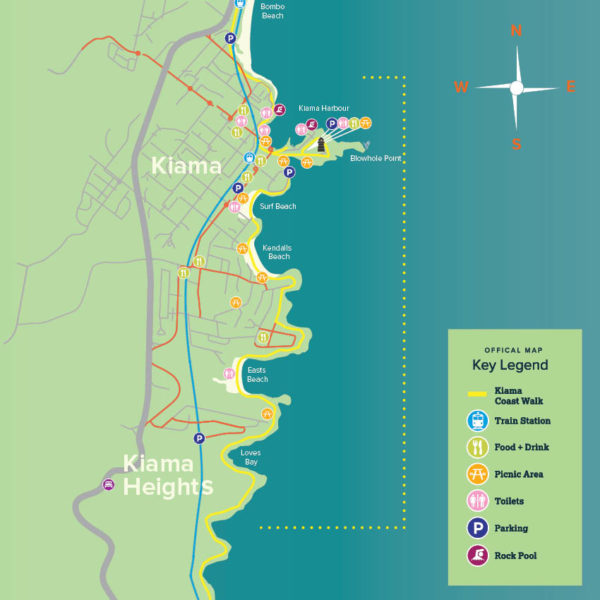
The midsection of Kiama Coast Walk. Image: Destination Kiama.
The South Section
The south section of the walk is from Loves Bay to Gerringong and boasts the most untouched areas, with some hills and climbs required.
The route is a zig-zag of coastal pastures south from Kiama Heights to Werri Beach with exposed clifftops, rainforest remnants and endless ocean views. But the weather can play a factor so be prepared for all possibilities.
The South Coast railway also makes an occassional appearance going through tunnels carved more than 120 years ago.
After reaching Werri Lagoon, for the final stretch you can choose to walk along Werri Beach or the adjacent sidewalk heading south. When you see the final green headland from which you can either follow Belinda Street another 1.5 km to the train station or loop to finish up at the boat harbour.
This 6 km section will take around two hours but if you’re still up for more, you can continue south towards beautiful Gerroa which will add an extra 45 minutes.
Maps, videos and tips on this walk are available on the Destination Kiama website.
The south section of the Kiama Coast Walk. Image: Destination Kiama.
Minnamurra Rainforest
The award-winning attraction in Budderoo National Park is a network of elevated walkways and paved tracks with two walk options to explore this rare remnant of subtropical and warm temperate rainforest.
The site also has visitor information services, a retail shop, cafe and picnic and barbecue facilities, with guided tours also available by prior booking.
Park entry fees are $12 per vehicle per day, with park gates locked at 5 pm and last entry by 4 pm.
Rainforest Loop Walk
The Loop Walk is a 1.6 km walk which is linked by suspension bridges across the Minnamurra Rivulet.
It is a huge hit for people of all ages with the diversity of plant and wildlife species on display whether it be bird’s nest ferns, strangler figs or colourful orchids.
The first 500 m of the track also provides assisted wheelchair access.
The entire loop takes between 45 minutes and an hour to complete.
The Falls Walk
Halfway around the Loop Walk, there is the opportunity to deviate up the paved Falls Walk.
This walk is a little more challenging and steep in parts, measuring around 2.6 km return.
It has spectacular views over the rainforest canopy and the gorge carved by Minnamurra Rivulet and concludes with a viewing platform and rest area at the base of the Upper Falls.
This walk takes about an hour to complete, with the two walks combined being 4.2 km and taking around two hours.
Kiama Cycling Routes
Kiama’s cycle guide outlines nine itineraries tailored for recreational rides allowing cyclists of all experiences to jump in the saddle and find a route that suits them.
These routes help cyclists to explore the region in a safe way that is appropriate to their level with a mix of shared paths, cycleways and road riding.
They are classified as easy (flat, mostly off road shared paths suitable for families), moderate (some hills and quiet roads, for confident riders) or hard (steep hills and roadways, for experienced riders).
Full route details and maps can be found in the Kiama Rides guide.
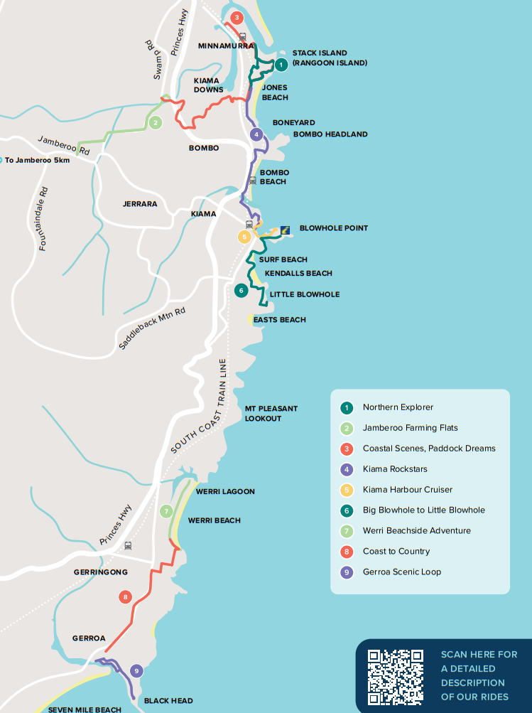
The nine routes in Kiama’s cycling guide. Image: Kiama Rides.
Northern Explorer
This 4.2 km loop is a moderate difficulty starting from Kiama Downs Surf Life Saving Club and travelling through the shared paths of Minnamurra Headland and returning via quiet streets.
For more adventure there is a Minnamurra Bike Skills Track located on Ritchie Place, featuring downhill tracks, pump tracks, and a junior track.
There are some steep sections and on-road riding required, with the loop taking around 20 to 30 minutes to complete.
For those looking for more distance, the route can connect onto Shellharbour via the shared path north of Minnamurra River, through Casuarina forest and past the disused Dunmore Railway station (8.3 km one way) or further to Shell Cove Marina (10.1 km one way).
Jamberoo Farming Flats
This route starts near the Minnamurra River Crossing on Swamp Road where there’s a shared path which leads to Kiama Downs.
Pedal south along the flat family-friendly path past the paddocks and residing cows down to Browns Lane where you turn around and head back to where you started.
The easy ride is 6.4 km return along a flat path with no shelter or services and will take around 25 minutes.
A shared path extension will soon add 2 km to this track.
Coastal Scenes, Paddock Dreams
This diverse scenic route will take you 7.3 km one way along the coast and through wetlands, rivers and farmland.
It starts on Trevethan Reserve on the Minnamurra River heading south and turning onto The Village, through a rail underpass, crossing over the Minnamurra Headland then west through another rail underpass before crossing Riverside Drive.
An off-road route leads riders through Kiama Downs and eventually to a steep climb up Henry Parkes Drive, then to another off-road section around a picturesque billabong, ending at Swamp Road Jamberoo.
The route is of moderate difficulty with steep sections and road crossings along a combination of shared paths and quiet streets.
It will take 50 to 60 minutes to complete.
Kiama Rockstars
This 30-minute, moderate difficulty route starts at Kiama Downs Surf Lifesaving Club heading south along North Kiama Drive and Cliff Drive with a chance to see the Cathedral Rocks, Boneyard Beach and unique landscape of Bombo Beach.
Riders can then descend via the newly built stairs with bike channel or continue along headlands crest, riding along Bombo Beach and taking an exit on Hothersal Street and onto Gipps Street where a final climb lies as riders work up to Pheasant Point Drive.
This ride is 4.8 km one-way, with the potential to connect to other routes or return for a longer trip, with shared path, quiet streets and on-road conditions.
Kiama Harbour Cruiser
This easy cycling adventure can be started at either end of Kiama Harbour with the shared path treating riders to picturesque views of the harbour and Black Beach.
It is a 2 km return route and will take around 15 minutes if you don’t stop to spot some pelicans or stingrays at the boat ramp.
This popular area can often be a buzz of activity so beware of pedestrians and other riders.
Big Blowhole to Little Blowhole
Taking around 20 minutes and measuring 3.7 km one way, this moderately difficult route allows you to see not one, but both of Kiama’s blowholes.
It begins at Blowhole Point Road at the Kiama Blowhole, then heads south down around the showground, twisting around the coastline and past Surf and Kendalls beaches. There is a steep climb up Bonaira Street before reaching your final destination of the Little Blowhole.
This route is a mix of shared paths and quiet streets.
Cyclists are urged not to try and continue on to Gerringong from the Little Blowhole as the Kiama Bends highway is not bicycle friendly; instead, a train can be taken from Kiama Station to Gerringong Station.
Werri Beachside Adventure
This easy route is perfect for beginners and young families and is along a flat, shared path.
The path begins at the north end of Werri Beach on Pacific Avenue where riders can travel south passing picnic areas, a water station, kiosk, playground and skate park then along the southern headland to South Werri Ocean Pool and all the way back.
It is 4.2 km return with lots of amenities to make the most of the experience.
Coast to Country
This one is for more experienced riders, adventure seekers or those with e-bikes due to its steep sections and busy roads.
The 4.2 km one-way route starts at Gerringong Bowling Club with an immediate challenging ascent up a steep hill to Gerringong Cemetery and Whale Watching Platform.
Then riders travel along Belinda Street and some quieter back streets towards Fern Street, where they will head south and soak in the sweeping views of farmland and the escarpment on one side, and the stunning coast on the other.
The last stretch is on road towards the final destination of Sir Charles Kingsford Smith Memorial Lookout, offering views of Seven Mile Beach.
This route will take around 30 minutes to complete and is categorised as hard.
Gerroa Scenic Route
Starting at Emery Reserve, this ride can be easily continued from the Coast to Country route or completed as its own challenge.
Riders start the moderately difficult route by heading up Riverleigh Avenue, onto Stafford Street and easing their way to Black Head Reserve and Gerroa Headland.
To complete the loop, cyclists trace the banks of the Crooked River through Burke Parade and head back to their starting point.
This route is on quiet streets and is 3.4 km, taking around 20 minutes.