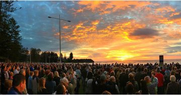
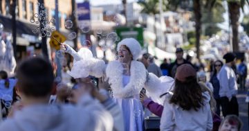
Helensburgh, Windang, Kiama … Bomaderry – where did the Illawarra begin and end? Photos: Zoe Cartwright, Jen White, Eileen Mulligan, Wikimedia.
Back in 2001 at a big Sandon Point protest I ran into an old friend, the now late Guboo Ted Thomas. He was by then in his 90s and the famed senior indigenous lawman came from Wallaga Lake. So I said, “What are you doing here Ted?” He replied, “This is Yuin country”.
Wallaga near Narooma is a long way from Sandon Point and this made me begin to reconsider where on earth the Illawarra – an indigenous word of uncertain meaning – originally began and ended?
Dubbed The Five Islands by the whites, even the word Illawarra was possibly a corruption of Allowrie but where Allowrie began or ended (or had a middle) I have no idea.
Yet beginnings, ends and middles were once a big issue in some parts of Illawarra. Shellharbour, of course, began at the harbour and that’s where the first council hung out in 1859 – even though many whites were then still calling the place Peterborough.
Shellharbour’s civic centre then moved to Albion Park. But in the mid 20th century when Warilla Grove got invented to service a large Housing Commission development, the centre sort of seemed to move, though unofficially, yet again. But the council building its new chambers a bit further south made that move look somewhat final.
But this only lasted until after Shellharbour Square got under way and council flogged off its Warilla Chambers. I suppose Central Shellharbour is now at least positioned sort of equidistant between the wilds of Albion Park, Lake Illawarra and the now almost defunct harbour where it had all begun.
Personally, after working for three decades beside Lake Illawarra, I long assumed the Illawarra actually ended at Windang where Illawarra’s two finest local historians – Zac and Billy from the band Hockey Dad – have produced video evidence that it is definitely the finest place in the universe.
But, as I’ve always also liked the train ride from Thirroul to Kiama and on to Bomaderry, I’ve long wanted Illawarra to end at the seeming end of the rail line.
And, strangely, Illawarra did once end near Bomaderry – at least if one looks east towards Coolangatta.
Impressively, the first policeman in Illawarra was very inconveniently stationed at Alexander Berry’s vast Shoalhaven property. Thus Stanwell Park became a pretty safe hide-out for bushrangers as it would take the cop a long while before he was told of a crime – let alone set off on horseback, crossing various watercourses, to get even as far as Wollongong.
But even to extend Illawarra as far as Coolangatta is actually a touch conservative.
For Australia’s most famous businesswoman – the land baroness Mary Reibey of $20 note fame who held 3700 (1497 ha) Shoalhaven acres – also owned another 800 acre (323 ha) property at Burrier which was close to today’s now more famous Bundanon.
Mrs Reibey’s grandson – James Thomson – often visited Dr McKenzie’s Bundanon (supposedly, just “three miles by river” from Reibey’s Burrier House) so it was little surprise, in such an isolated location, he ended up marrying McKenzie’s daughter.
Stuck in the true Australian wilderness at Burrier, by 1869 Dr Mackenzie fled after inheriting the Scottish Lairdship of Ardross and Dundonnell. His son then got Shoalhaven’s Bundanon long before Arthur Boyd got his paint-stained hands on it.


So did Yuin country extend along most of the near and far south coast? And how far north might it today extend?
Historical Illawarra – although today bordering the Royal National Park and beginning somewhat to its west at Mt Westmacott (named after the white bloke who settled at Sandon Point in 1837) – once extended quite a way down the coast.
It thus might be said to have once included the Kiama Blowhole and Minnamurra Rainforest as it finest natural attractions, along with the Berry Estate at Coolangatta and then west to the lovely Cambewarra and onto Bundanon and Burrier.
Today, however, shrink-flation has had its impact not just on the supermarket shelves. Illawarra now only seems to extend from somewhere near Otford to somewhere around the middle of Lake Illawarra.
These days I have even heard some living in northern Illawarra cry “bring back Bulli Shire Council”. And, indeed, I suspect that, if the rates for land between Bulli and Otford were whacked up sufficiently, there may even be enough wealthy northerners to make such a re-establishment stack-up financially.
Terrifyingly, Illawarra may well even be moving quite a way further north, if the recent northern suburbs shop-front sign “Meditation: Bondi-Thirroul” is anything to go by.
Wollongong is today said to be located on the traditional lands of the Dharawal (very variously spelt) ranging from roughly Botany Bay to Jervis Bay.
Yet a Tharawal Local Aboriginal Land Council is located at Couridjah in the Wollondilly Shire. And the Illawarra (South Coast region) is covered by at least 12 Local Aboriginal Land Councils starting at Eden.
I note too that these days the ABC when broadcasting from Canberra acknowledges the Ngunnawal people while also acknowledging “other custodians”. And Ngunnawal country is said to be bordered by “Wiradjuri, Ngarigo, Gundungurra and Yuin lands”.
Guboo Ted Thomas (who told me in 2001 that Sandon Point was Yuin country) himself had been born in 1909 under a gum tree at Jembaicumbene in the Braidwood area. He died in May 2002.