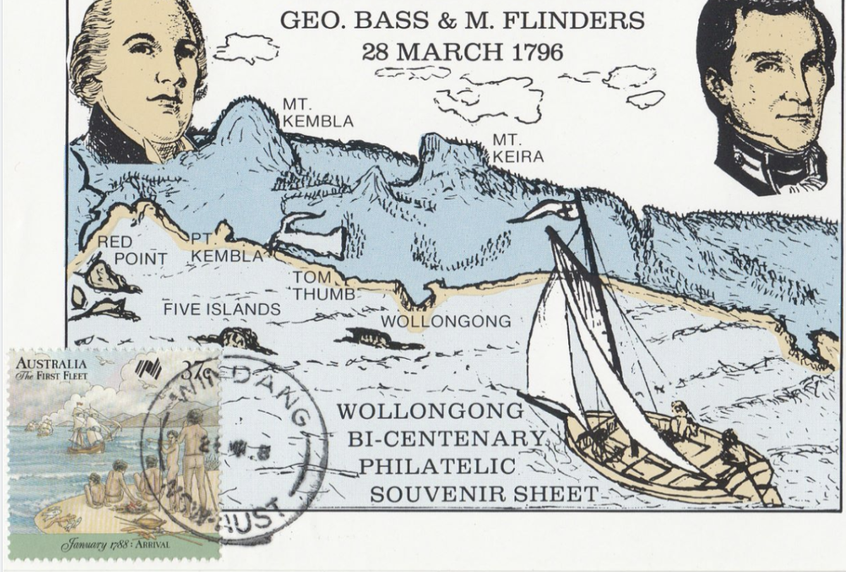
Bass and Flinders Australia Post philatelic sheet issued in 1996. Photo: Supplied.
In 1770 Captain James Cook thought he’d take a look in case he discovered Sydney – and he did, didn’t he?
But, unfortunately, Cook mostly sailed too far out to sea to precisely see what was on the Illawarra coast of the Indigenous people whose hereditary property it was in perpetuity.
Eventually, however, Cook made landfall (after a failed attempt at Woonona Point) at what Sir Joseph Banks named “Botany Bay”. Remarkably, although naming “Port Jackson”, Cook never sailed into the fabulous Sydney harbour at all.
When passing Illawarra, Cook claimed to have sighted “Red Point”. The other landform Cook described was “a round hill the top of which look like the crown of a hatt”.
Most people now believe that what Cook was describing is today’s Mount Kembla – although very much depends on the possibly unknowable matter of what shape Cook considered a “hatt” should look like.
For all we really know Cook might have been describing nearby Mount Keira. And it does seem odd that Cook didn’t mention seeing both peaks.
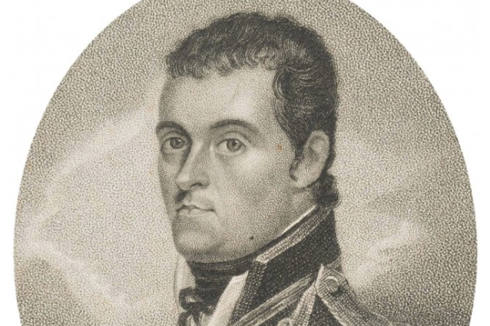
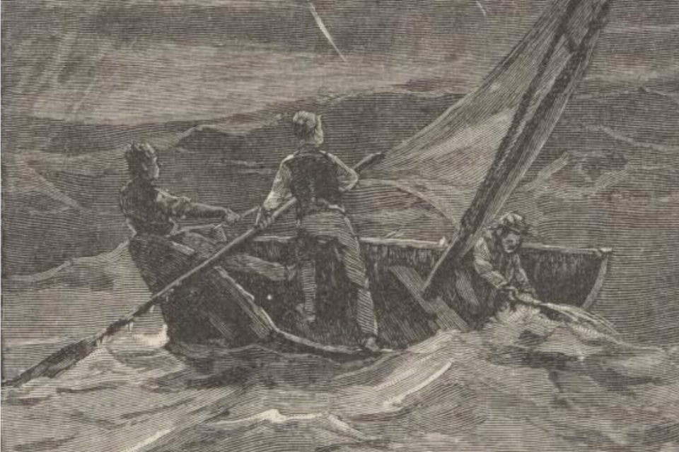
Matters about hats and hills become even more confusing when we read of the next white invaders who sailed from Sydney towards what is today widely thought to be Captain Cook’s “Hat Hill”: the voyage of Bass and Flinders and the boy Martin in the tiny boat “Tom Thumb II” in 1796.
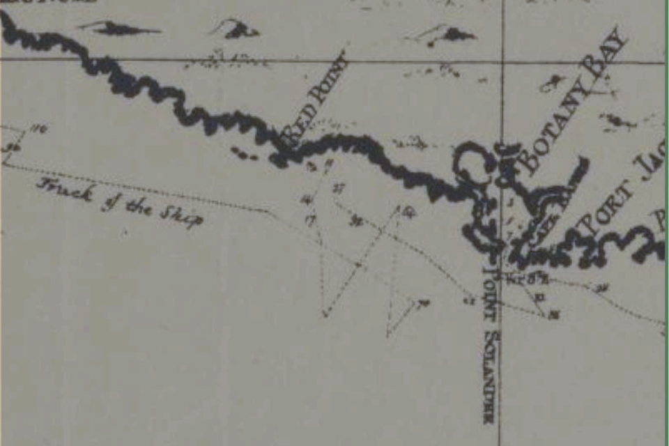
The relevant passage from Flinders’ A Voyage to Terra Australis is as follows: We sailed out of Port Jackson early in the morning of March 25 and stood a little off to sea to be ready for the sea breeze. On coming in with the land in the evening, instead of being near Cape Solander, we found ourselves under the cliffs near Hat Hill, six or seven leagues to the southward, whither the boat had been drifted by a strong current.
The first problem here is that “six or seven leagues south of Cape Solander” does not seem to put us even within coo-ee of what is thought to be Lt James Cook’s “Hatt Hill” – today known as Mount Kembla.
But in these early seafaring journals the use of the term league is often problematic.
Flinders himself is here being less than precise and further confuses by also using the term “miles” for other sea distances he describes.
But the problem remains that a distance of even seven leagues would not seem to put Flinders sufficiently close to Red Point or Cook’s “Hatt Hill” in Illawarra.
Previous historians have given Flinders the benefit of the doubt in approximating the actual distance. But in doing so they ignore the additional difficulty of whether or not there are landforms that one would describe as “cliffs” preventing landing “under” or near “Red Point”.
Flinders’ journal simply cannot be precisely understood unless one grants the possibility that there may be two “Hat Hills” – one in the Illawarra and another more “northern Hat Hill” located some “six or seven leagues’” south of “Cape Solander”.
Moreover, Flinders also mentions this Northern Hat Hill at the start of his “Narrative of the Sloop Norfolk” in which vessel he circumnavigated Tasmania with my First Fleet ancestor Peter Hibbs serving as the Norfolk’s “colonial master”.
Curiously Flinders, when naming Tasmania’s Point Hibbs after my ancestor, wrote that it “appeared like the crown of a hat” – the same wording Cook had used for a hill when sailing past Illawarra: At daylight October 7th [1798] weighed from the [Sydney] Cove … About 9 o’clock passed between the heads, the sea breeze coming from the NE. By 4 o’clock Hat Hill bore true west, eight leagues from which we took our departure, steering a course parallel with the coast.
This same “Northern Hat Hill” closer to Cape Solander is also later mentioned as being where a “colonial vessel” named the Venus “made the shore at a place called Hat Hill, about 8 miles south of Botany Bay” – as reported on the front page of the Sydney Gazette published on 2 April 1809.
I am thus hesitant to fully support the contention that Flinders simply got his distances wrong and actually meant Cook’s Illawarra “Hat Hill” rather than the one said to be closer to Botany Bay.
We all make mistakes of course. So “hats off” to any historian who can conclusively sort out the conundrum of there, apparently, once being two too many visible “Hatt Hills” off the coast between Sydney and Wollongong.