Cordeaux Dam is one of several nearby water reserves that boast beautiful scenery and great picnic spots. Photo: NSW Government.
When we have the ocean at our doorstep and the beautiful Lake Illawarra close by, it’s easy to forget there are other vast water areas within an easy drive of the Illawarra.
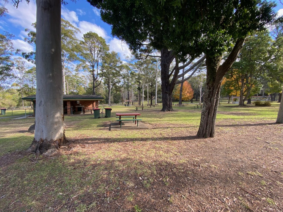
While we tend to think of our nearby dams simply as the places that supply our water, they are actually great places to visit, explore and have a picnic.
Before you head out to visit these five dam fine spots, it’s wise to check Sydney Water’s website to make sure they’re open. Picnic areas at all dams are closed on Total Fire Ban days.
Most have electric barbecues, hot water, toilets and playgrounds, so throw a picnic together and discover the stories behind these massive water reserves.
If you see a hazard or an incident at any of the dams, call Sydney Water’s incident reporting line on 1800 061 069.
Cordeaux Dam, Picton Rd, Cataract
7.8 sq km, capacity 94 gigalitres (gl)
Free entry 10 am to 5 pm daily; 10 am to 7 pm on weekends and public holidays during daylight saving (no entry 15 minutes before close).
Facilities: Electric barbecues, drinking water, hot water, toilets, children’s playground, lots of space to kick a ball around.
History: Cordeaux is one of four dams that make up the Upper Nepean water supply scheme on the Illawarra Plateau. Construction of the dam started in 1918 and was completed in 1926. The picnic area is on the site where the dam builders lived in the 1920s. Keep an eye out for remnants of an old road, drains and a tennis court.
There’s plenty of room to spread out at Cordeaux Dam. Photo: Jen White.
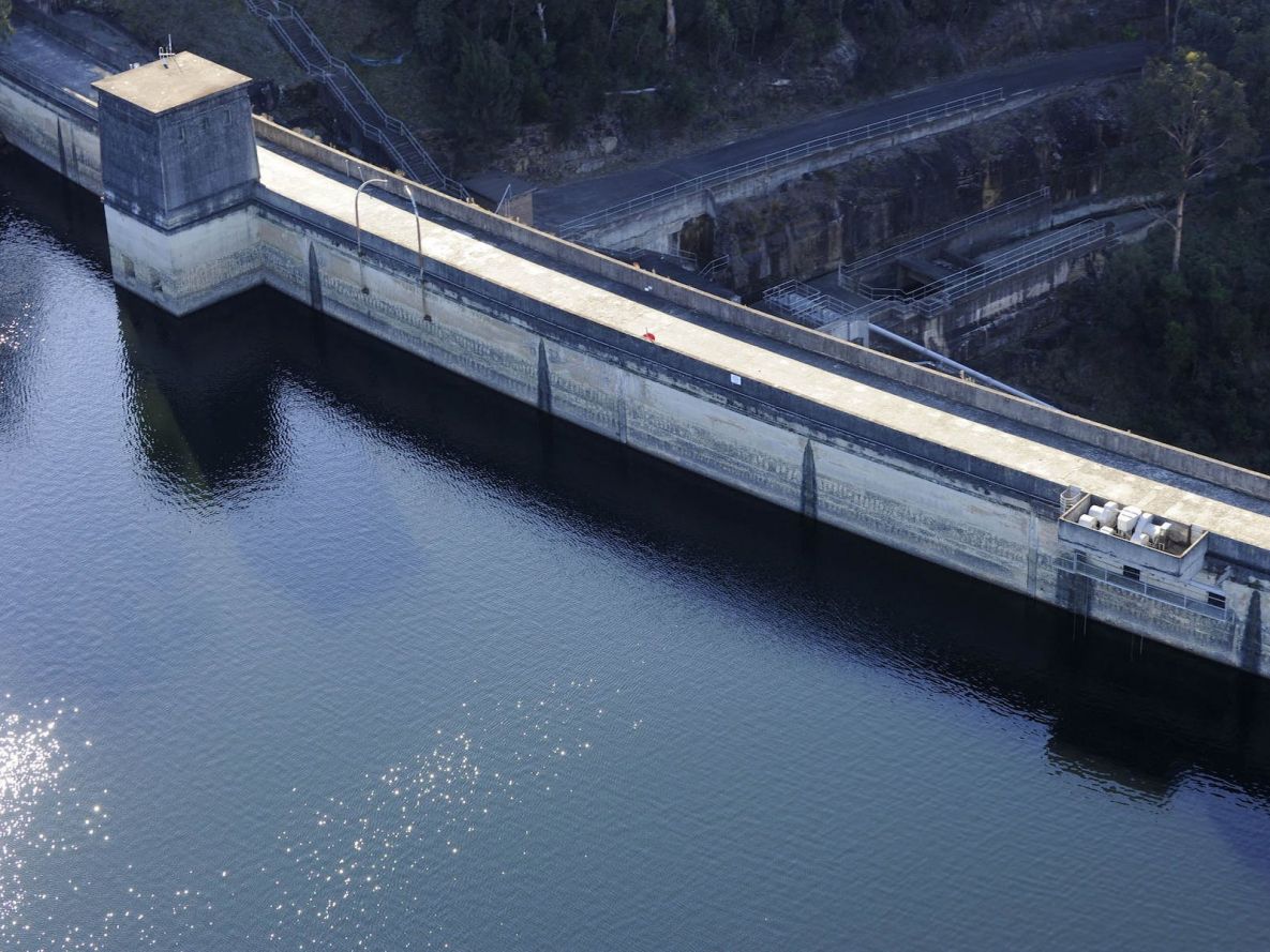
Things to see: Drive or walk along an avenue of Monterey pines to the lower carpark near the dam wall. The wall and picnic area provide excellent views of the lake in its natural bushland setting.
Massive Egyptian-style stone gateways guard the entrance to the dam wall, and the leafy picnic grounds feature stands of tall pine trees and other reminders of past times. The gates were inspired by the popularity of all things Egyptian following the discovery of King Tutankhamun’s tomb in 1922. Take a walk across the curved wall of the dam. It’s longer and lower than the other Upper Nepean dam walls – 405 metres long but only 57 metres high. Walk to the end for an impressive view of the spillway, framed through the Egyptian-style archway.
A plaque on the valve house on the dam wall pays tribute to Guy Chalmers-Clift, 37, the resident engineer in charge of the dam’s construction. On 10 March, 1924, Clift and Constable James Flynn, 27, a local police officer, were shot while taking a suspect to Appin Police Station after a bungled attempt to steal the Cordeaux payroll. The intoxicated prisoner, William Simpson, 34, was later captured at the Royal Hotel in Appin and was charged with the two murders. He was hanged at Long Bay Gaol in December 1924. A memorial to Jack Clark, the dam’s resident officer from 1964 to 1977, can also be found in the feature garden in the picnic grounds.
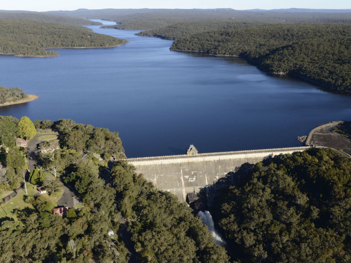
Construction of Cataract Dam took five years and was completed in 1907. Photo: NSW Government.
Cataract Dam, Cataract Rd, Appin
8.5 sq km, capacity 97 gl
Free entry 10 am to 5 pm daily; 10 am to 7 pm on weekends and public holidays during daylight saving (no entry 15 minutes before close).
Facilities: Electric barbecues, picnic tables, drinking water, hot water, toilets, children’s playground.
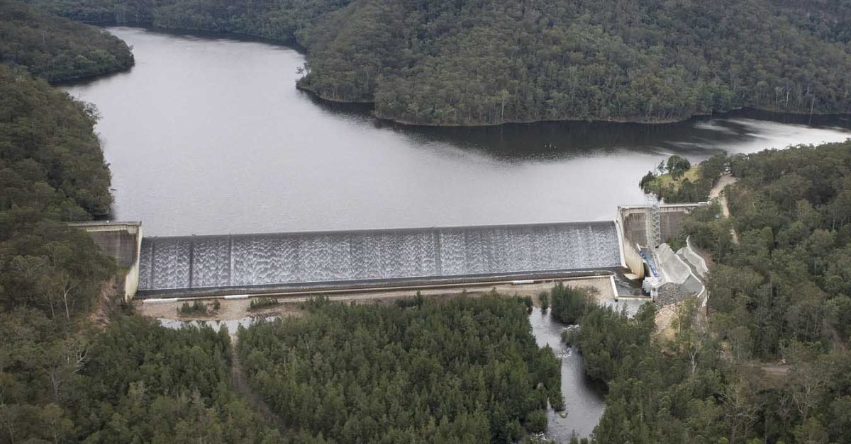
History: Cataract Dam is one of the oldest and most picturesque in Sydney. At the time of its construction from 1902 to 1907, it was the biggest engineering project in Australia and the fourth biggest in the world. It was the first of the four dams constructed to collect water from the Illawarra Plateau, created by damming the Cataract River. Cataract Dam still boasts a set of cottages that date from the dam’s construction, built with sandstone quarried on site. The official quarters are an example of a Federation Queen Anne bungalow, with matching outbuildings and landscaped gardens surrounded by a castle-like sandstone fence.
Things to see: Look out for reminders of the dam’s glory days as a picnic spot in the 1920s and 1930s, when Upper Nepean dams competed for the most beautiful gardens. Remnants of ornamental gardens, grotto shelters, decorative walls and ferneries are scattered throughout the upper picnic area, and near the dam wall is a concrete faux-log bridge. Walk down the steps and across the dam wall for magnificent views of the lake and Keele Island upstream, and of the deep Cataract Gorge downstream. If you walk the full 247 metres to the other end, you’ll glimpse the dam’s spillway. Near the centre of the dam wall stands the valve house, finished in weathered sandstone.
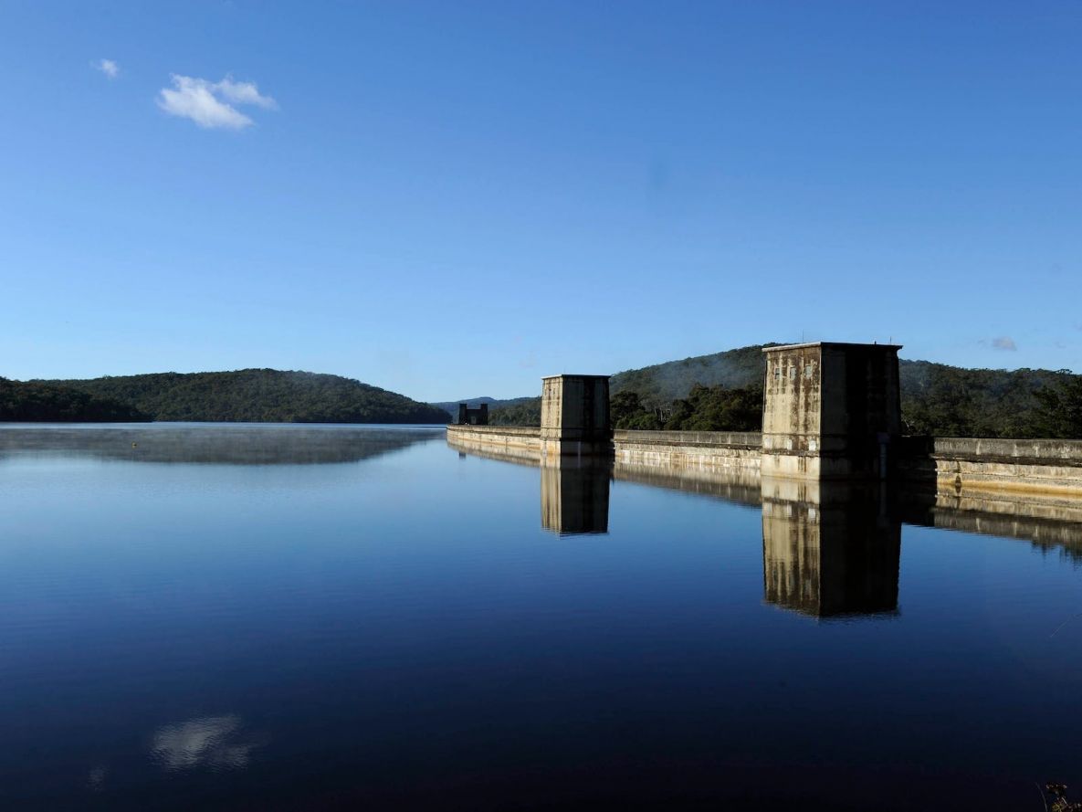
Avon Dam wall is 72 metres above the river. Photo: NSW Government,
Avon Dam, Bargo (take the Bargo exit off the Hume Hwy)
10.5 sq km, capacity 142 gl
Free entry 10 am to 5 pm daily; 10 am to 7 pm on weekends and public holidays during daylight saving (no entry 15 minutes before close).
Facilities: Electric barbecues, drinking water, picnic tables and toilet facilities throughout the grounds. There’s a row of older-style picnic shelters closer to the dam walk and lake.
History: Avon Dam was the third and largest of the four dams constructed to collect water from the Illawarra Plateau. Created by damming the Avon River and constructed from 1921 to 1927, Avon’s main role today is to supply water to the Illawarra. It is Sydney’s second-largest dam after Warragamba, but has a small catchment. Like Cordeaux Dam, massive stone gateways guard the entrance to the dam wall and the grounds. The gates were inspired by the popularity of all things Egyptian following the discovery of King Tutankhamun’s tomb in 1922. The dam’s recreation area reopened to the public in November after a three-year closure due to flood damage. A major landslip on the access road into the dam, and minor landslips on the spillway walkway, were repaired, and work was done on the spillway bridge and the bridge over the Nepean River.
Things to see: From the top picnic area, drive or walk above the concrete spillway to the lower carpark near the dam wall, then walk across the wall for impressive views of the lake upstream and gorge downstream. It’s 223 metres to the other end, and you’re 72 metres above the river. Look downstream and you’ll see the rockfill embankment built in the 1970s to strengthen the wall. As you walk from the dam wall to the viewing area near the spillway, keep an eye out for remnants of fountains and ponds to your left, and an old fernery to your right.
From the lower carpark near the dam wall, walk south along a flat pathway to a viewing area near the serpentine spillway for more views of the lake.
Tallowa Dam has a lift to help fish migrate between the upper and lower Shoalhaven River. Photo: Bob Peters.
Tallowa Dam, Tallowa Dam Rd, near Kangaroo Valley
9.3 sq km, capacity 7.5 gl
Open 24 hours.
Facilities: Electric barbecues and picnic tables, canoe-launching point, toilets. No safe drinking water.
History: Tallowa Dam’s fish lift was a first in NSW and the largest of its kind fitted to an existing dam in Australia. The dam had been a barrier to the migration of native fish since it was built in the 1970s. Now, fish ride in a 2500-litre bucket along a 30-metre track up and over the dam wall. By allowing fish to migrate between the lower and upper Shoalhaven River, the lift helps protect 10 native fish species, including the endangered grayling. Tallowa is the centrepiece of the Shoalhaven system that provides water to the Shoalhaven and Southern Highlands regions, and a back-up to the Sydney and Illawarra water supplies.
Things to see: A viewing area at the start of the dam wall provides vistas of the fish lift, lake and surrounding bushland of Morton National Park, and an interpretive sign about the lift. The dam wall is more than half a kilometre long but only 43 metres high. From the upper viewing area, it’s a short walk down a bush track to a lower viewing site for another perspective of the fish lift and dam wall. Lake Yarrunga, formed by Tallowa Dam, is a popular spot for canoeing, swimming and fishing. There are two canoe-launching areas – one north of the dam wall, so you can paddle upstream towards Bendeela Recreation Area and Kangaroo Valley, plus a launching area downstream of the dam wall, from where you can head down the Shoalhaven River towards Burrier and Nowra. The lake is also a popular spot for fishing, with good land-based angling also available at nearby Bendeela Recreation Area and Fitzroy Falls Reservoir fishing area.
Try your luck fishing for trout and bass in the Fitzroy Falls Reservoir. Photo: Adam Hollingworth.
Fitzroy Falls Reservoir, off the Nowra/Moss Vale Rd
5.2 sq km, capacity 10 gl
Facilities: Electric barbecues, picnic shelters and tables, drinking water, children’s playground and toilets.
History: Fitzroy Falls Reservoir is on Yarrunga Creek, upstream of Fitzroy Falls. It consists of four separate earth and rockfill embankments, completed in 1974 as part of the Shoalhaven Scheme.
Plans for a water supply in the Shoalhaven first arose at the end of World War I, but it was not until 1968 that the Water Board consulted the Snowy Mountains Hydro-Electric Authority about the longer-term water needs of Sydney and the South Coast. There was concern that Warragamba Dam, which had opened only eight years earlier, might not be enough to meet Sydney’s water supply needs by the mid-1970s. Construction of Tallowa Dam began in 1971 and was completed in 1976. Construction also started on reservoirs on the coastal range above Fitzroy Falls, and on the Upper Wingecarribee River. Fitzroy Falls and Wingecarribee reservoirs were completed in 1974. Water from Tallowa Dam, and Fitzroy Falls and Wingecarribee reservoirs, is now used to supply local communities and supplement Sydney and Illawarra water supplies.
Things to do: Try your luck fishing for trout and bass in the reservoir. Land-based fishing is available from designated areas on the eastern foreshore.